 |
ArcView and Arc
Info
Mapping of Various Shoreline
Features,
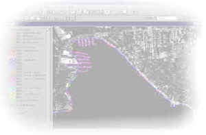
Lakes Michigan, Erie and Ontario Shorelines;
.
|
|
|
Development of ArcInfo
Coastal Zone Data Coverages,Lake Michigan Shoreline;
. |
|
|
Development of a GIS
Query and Data Visualization Tool - The Recession Rate Analysis
System - for Analysis of Great Lakes Coastal Zone Data;
. |
|
|
Development of
Internet Based GIS Viewer for Display of Natural Resource
Information and Mapping in the Zambezi River Basin, Africa;
. |
|
|
Integration of Quikmap
GIS with CODIS Oceanographic Inventory Database Management System;
. |
|
|
Quikmap and Quikvista
- Development and application of GIS map viewing system and image
analysis system;
. |
|
|
3-D Animation and
Mapping of Widow Rockfish Using Acoustic Fisheries Data - IBM
Visual Data Explorer;
. |
|
|
Development of GIS
Project Management Guidelines, British Columbia Ministry of
Forests, Prince Rupert District;
. |
|
|
Development of
Environmental Information Management System for Cataloguing,
Assessment and Mapping of Environmentally Sensitive Areas in the
British Columbia Gulf Islands;
. |
|
|
Development of City of
Victoria, British Columbia GIS Strategic Plan;
. |
|
|
Development of Environment Canada's Great Lakes
coastal zone database and GIS;
. |
|
|
Development of Yukon Forest Land Management System;
. |
|
|
Use of GIS to monitor and predict long-term Great
Lakes shoreline recession rates and to map areas of erosion hazards in
Southeastern Lake Huron;
.
|
|
|
Development of a comprehensive U.S. Great Lakes
shoreline recession rate database;
.
|
|
|
Development and mapping of Great Lakes shoreline
erodibility classification and erosion sensitivity index;
.
|
|
|
Design of an ecosystem coastal zone management
database and information system, Government of St. Lucia;
.
|
|
|
Application of GIS to support shoreland management
and coastal zone management planning;
.
|
|
|
User needs assessment, software product selection and
deployment of GIS to support coastal zone management of Ontario's Great
Lakes shoreline.
.
|
|
|
Littoral drift and sediment transport GIS prediction
and mapping system. |

 Staff and associates of
Christian J. Stewart Consulting have gained
considerable experience and expertise in utilizing geographic
information system technology through practical application in a number
of coastal projects.
Staff and associates of
Christian J. Stewart Consulting have gained
considerable experience and expertise in utilizing geographic
information system technology through practical application in a number
of coastal projects.